earthbuzz
earthbuzz is a symbol of sustainability and the environment and was created to represent the idea that everyone can make a difference in protecting the planet. It can be used in initiatives to promote green living and sustainability.
earthbuzz weather
earthbuzz limited is a mobile app company that developed and marketed the earthbuzz weather app from 2010-2015. Unfortunately the application was withdrawn from the iTunes App Store due to unforseen circumstances. This website provides some historical context regarding the earthbuzz app.
earthbuzz weather was one of the highest rated but also most obscure weather apps on the iTunes App Store and was unique in that it blended a 3D earth with social networking data and real-time animated satellite clouds, current weather conditions, weather forecasts and geological events. The app was written in C++ targeting OpenGLES and featured smooth and precise quaternion-based navigation and animation between favorite geographical locations.
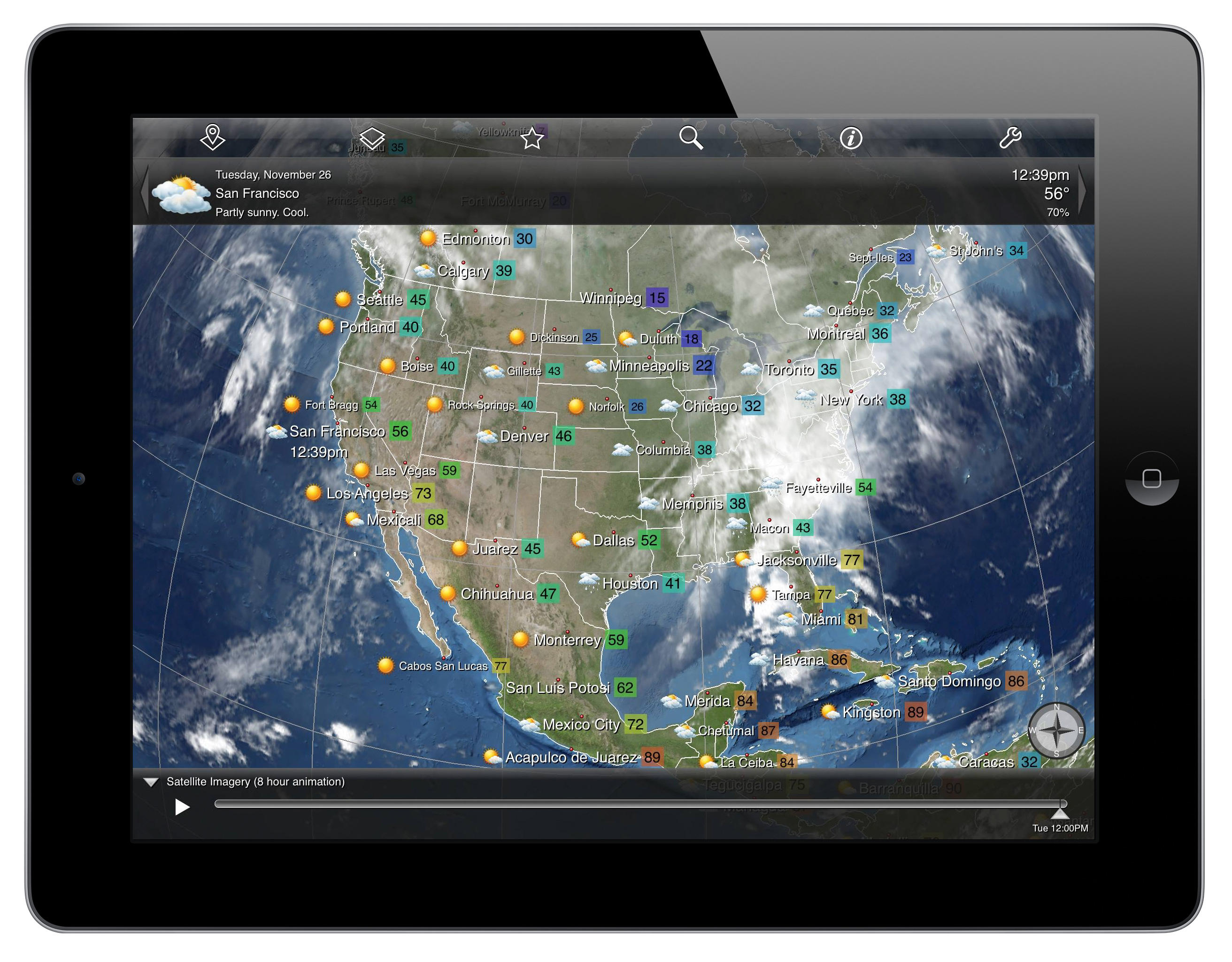
The earthbuzz app embedded NASA's Blue Marble imagery overlaid with real-time animated satellite clouds downloaded over the network plus shape layers with earthquakes, volcanoes, hurricanes and current conditions for airfield weather stations. Blue Marble: Next Generation was produced by Reto Stöckli, NASA Earth Observatory.
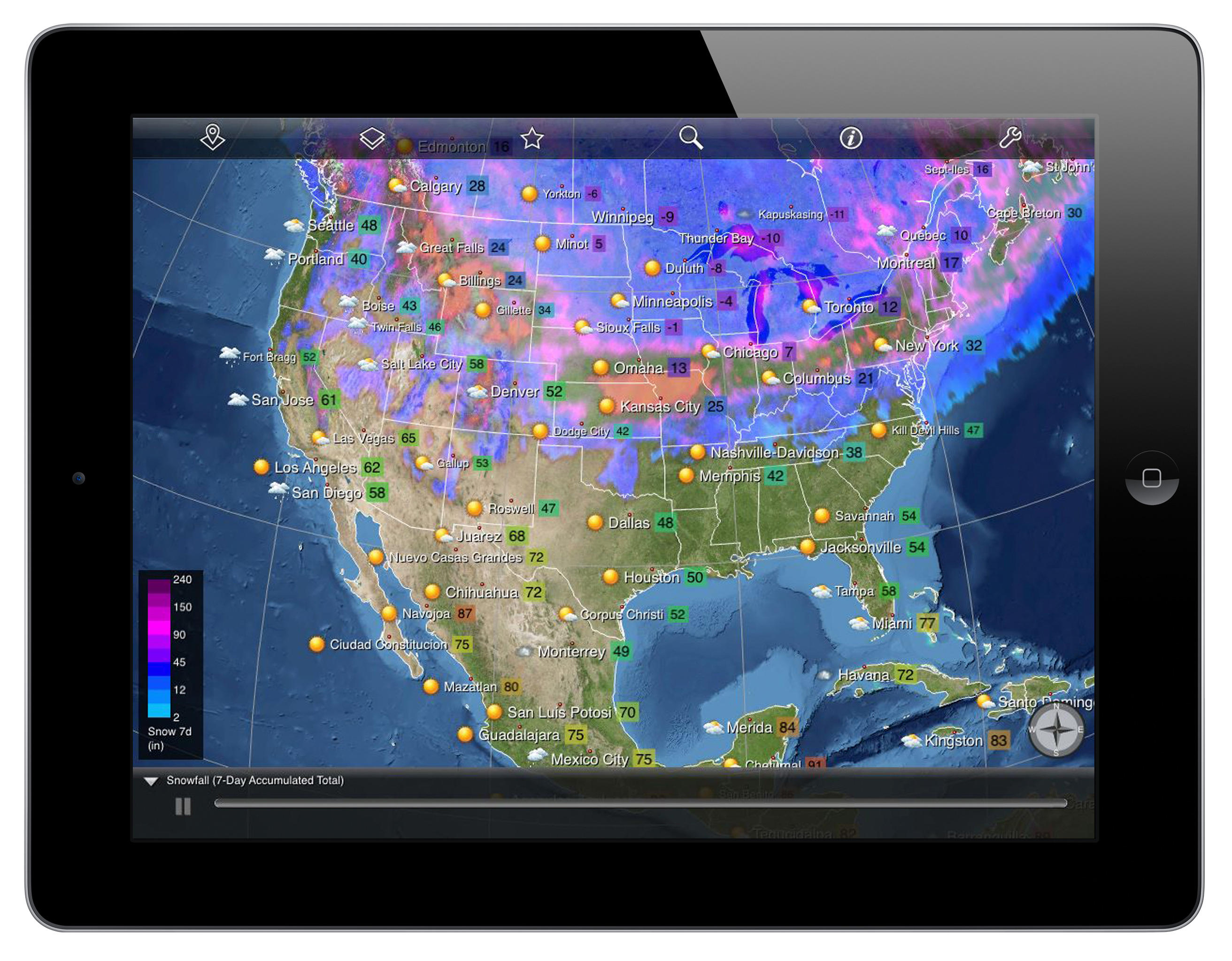
The earthbuzz global image layers included: animated satellite imagery, estimated precipitation, cloud cover, daily rainfall, 7-day accumulated snowfall, ice, relative humidity, min/max/mean temperatures, avg/max windspeed, storm potential (convective available potential energy), heating/cooling degree days, and soil moisture, as well as shape layers for hurricanes, earthquakes, volcanoes and observations. Weather data was provided by CustomWeather, Inc.
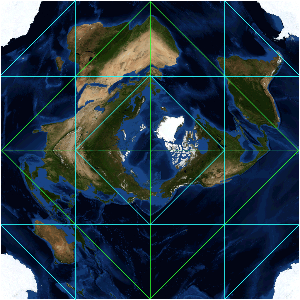
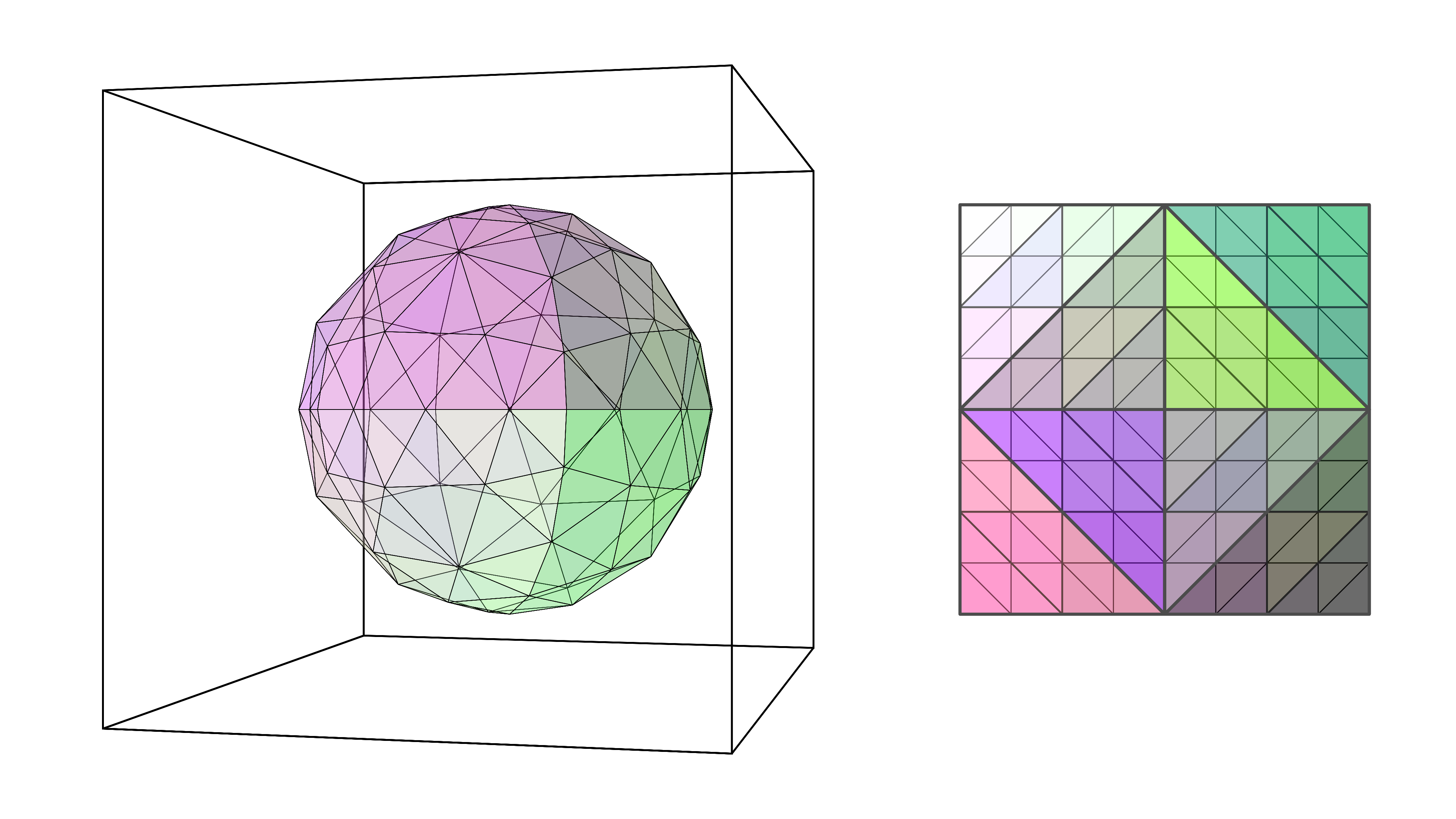
The earthbuzz app used the tessellated octahedron projection with recursive subdivision for tiled map layers. The tessellated octahedron is a novel projection with excellent texture linearity compared to equirectangular or mercator projections, and it naturally tiles for deep zoom due to the recursive square embedding. The figure shows a tessellated octahedron that has been recusively subdivided to the first level.
The earthbuzz app included a native mobile application for iOS/android plus web services infrastructure to fetch, transcode and cache satellite imagery, and to fetch and transcode weather condition data. The app supported asynchronous request batching for accelerated loading during pan and zoom of current condition data for thousands of geographically distributed weather stations.
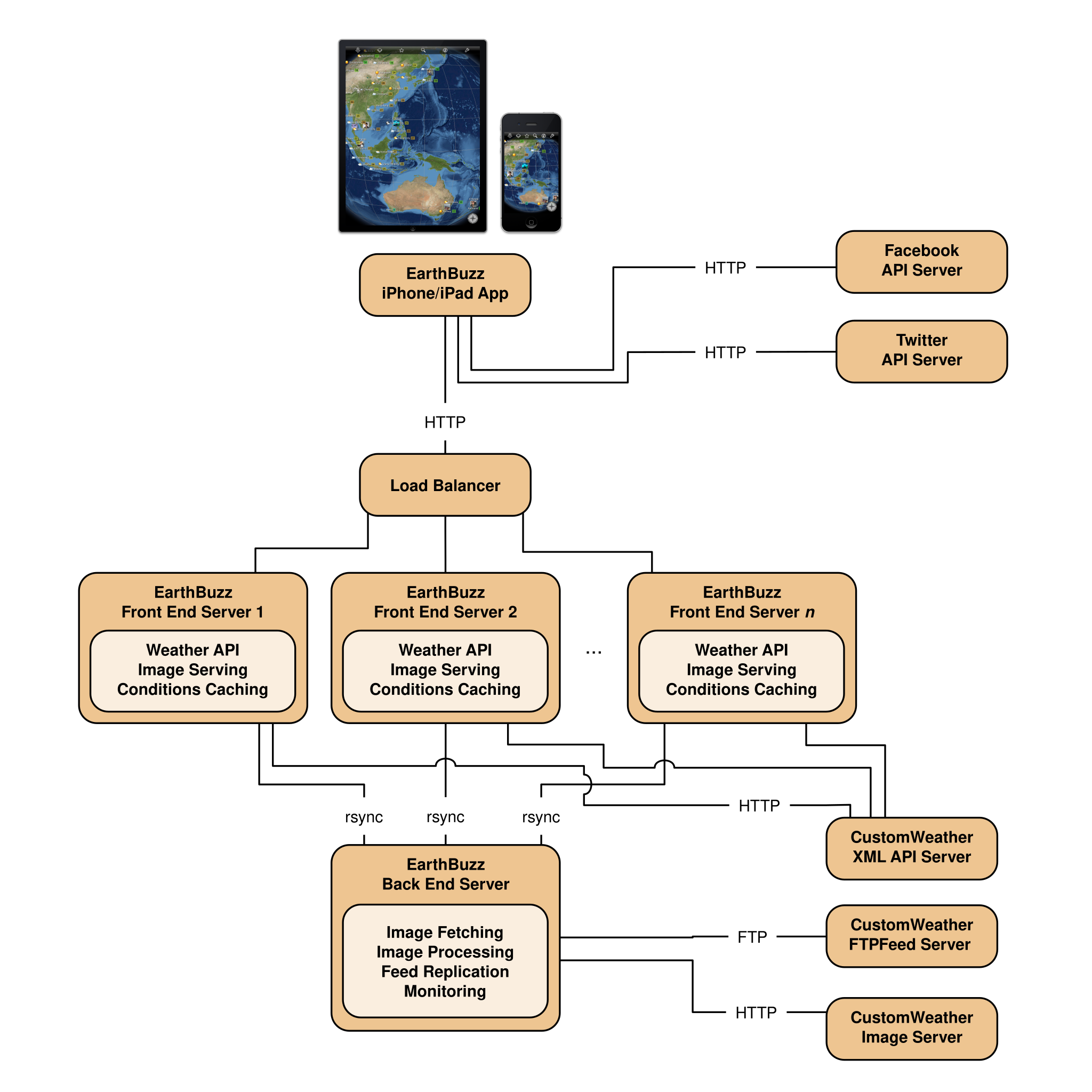
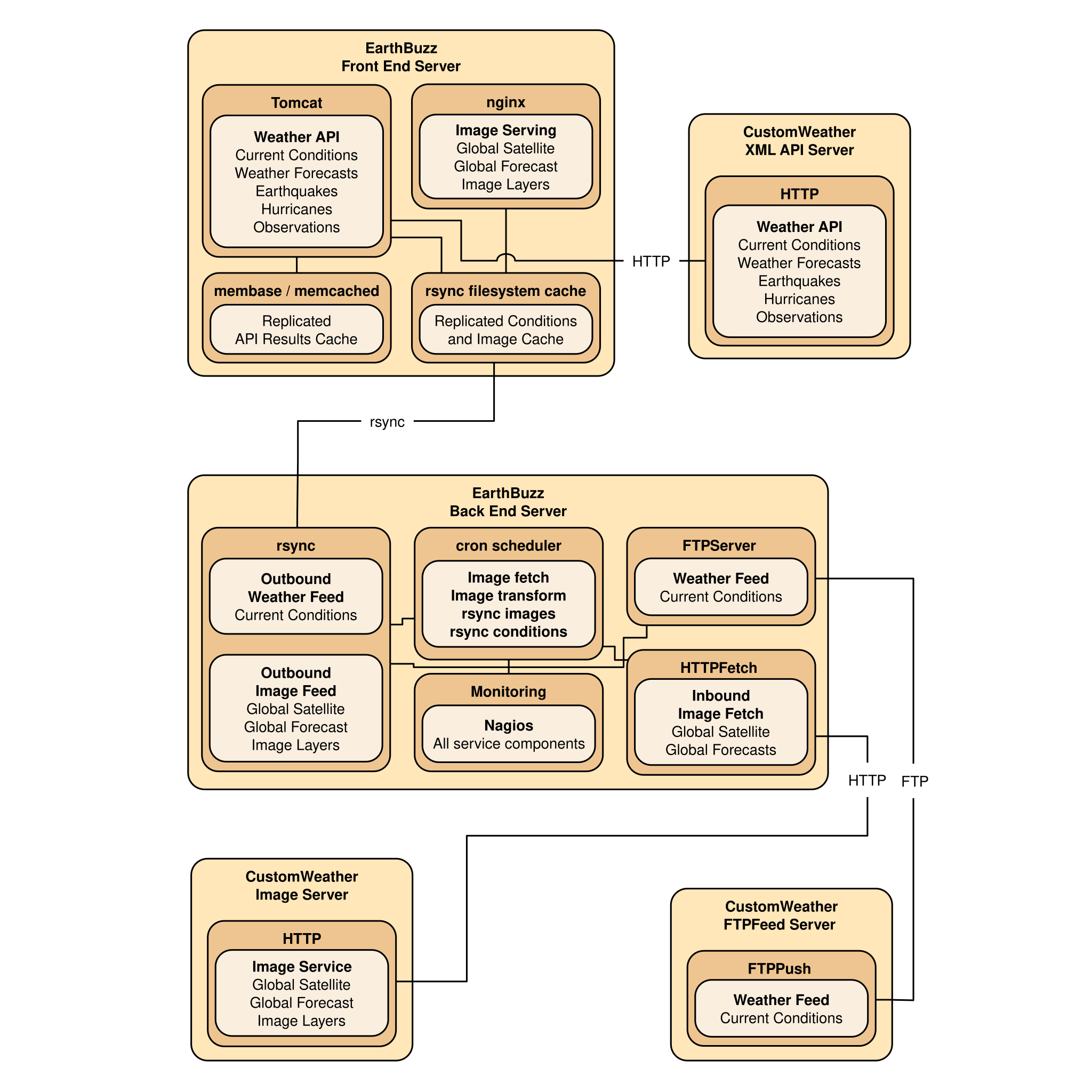
The earthbuzz app front-end service layer is composed of load-balanced servers to serve batch requests for cached current weather condition data and transcoded satellite image layers. The earthbuzz app back-end service layer is composed of an image transcoding service for the satellite image layers, and a data distribution service to replicate transcoded images and the weather condition feed to front-end servers.
This historical summary of the earthbuzz app gives some details behind the technology that went into creating the app. earthbuzz limited woud be pleased assist with proposals related to global geospatial events, web services, and cross-platform mobile application development for iOS and android. Please contact us for more information.